How Hard Is the Humantay Lake Hike?
Three kilometres sounds easy. At 4,000 metres, it isn't. Here is what the climb actually asks of you, and how to give yourself the best shot at the shore.
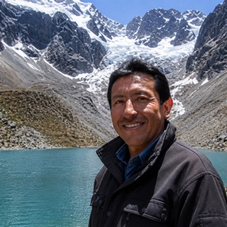 Written with Carlos Mamani, Humantay Lake tour guide & high-altitude specialist
Short answer
The hike is about 3 km one way with 300 to 470 m of gain on steep, rocky switchbacks: 1.5 to 2 hours up, about an hour down. The distance is modest. The altitude is not. Acclimatized beginners who pace themselves make it; unacclimatized fit people often struggle. Horses wait at the trailhead as a fallback.
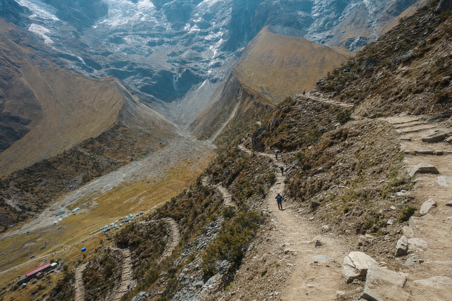
The first switchback above Soraypampa is where the day gets honest. Down at the trailhead everyone is laughing, adjusting daypacks, taking photos of the horses. Ten minutes up, the group goes quiet. All you hear is breathing. I have walked this trail with hundreds of groups since 2022, and the pattern never changes: the people who respect those first ten minutes reach the lake, and the people who charge them spend the rest of the morning paying it back.
So let me answer the question the way I would at the trailhead briefing, with real numbers and no drama.
How long is the hike to Humantay Lake?
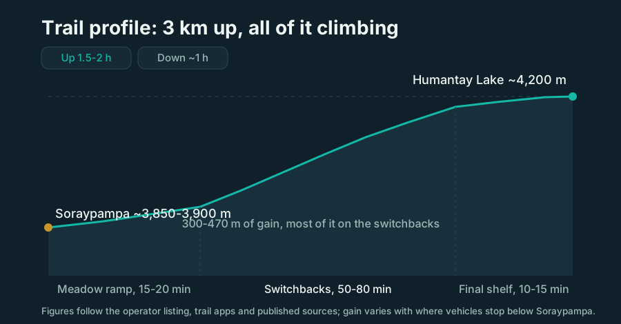
About 3 km one way from the Soraypampa trailhead, climbing 300 to 470 metres depending on where your vehicle stops. Most walkers need 1.5 to 2 hours going up and roughly an hour coming down. On paper that is a short morning walk. At this altitude it works your lungs like a hike three times that length.
The numbers deserve a second look, because they trick people constantly. Soraypampa sits at roughly 3,850 to 3,900 metres, and Humantay Lake sits at about 4,200 metres. You are doing all of your climbing in air that holds noticeably less oxygen than Cusco, which itself is already high.
| Trail fact | Figure | What it means on the ground |
|---|---|---|
| Distance one way | ~3 km | Short, but almost none of it is flat |
| Elevation gain | 300-470 m | Varies with where vehicles park below Soraypampa |
| Trailhead altitude | ~3,850-3,900 m | You start higher than almost any peak in Western Europe |
| Lake altitude | ~4,200 m | Roughly 800 m above Cusco's plaza |
| Typical time up | 1.5-2 h | Slower is normal and smarter |
| Typical time down | ~1 h | Faster, but loose rock demands attention |
Hiking apps rate this trail anywhere from moderate to hard, and honestly both are right. The grading depends entirely on the walker's acclimatization, which is why the same trail produces triumphant photos and miserable turnarounds on the same morning.
How steep is the trail, really?
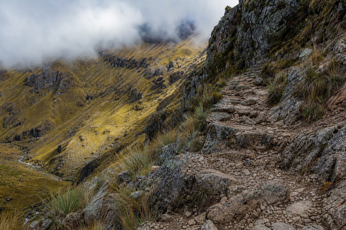
Steep enough that you will feel it immediately. The path climbs on rocky switchbacks with sustained grades that hikers regularly describe as brutal, including stretches recent visitors have measured at well over 40 percent. There is no exposure and no scrambling, just a relentless uphill on loose stone that never quite levels off until the lip of the lake.
I break the trail into three sections when I brief a group, because each one behaves differently.
| Section | Character | Roughly how long |
|---|---|---|
| The meadow ramp | Gentle rise across pampa grass, deceptively easy | 15-20 min |
| The switchbacks | Steep, rocky zigzags, the heart of the climb | 50-80 min |
| The final shelf | Short push over the moraine lip to the shore | 10-15 min |
The meadow is where people burn energy they will want later. The switchbacks are where the altitude collects its fee. And the final shelf is the cruel bit: you can hear people at the lake above you while your legs argue about the last hundred metres.
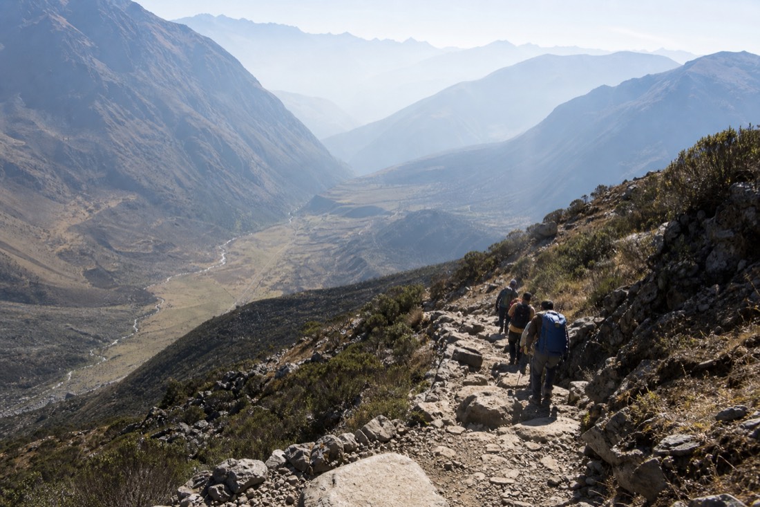
Coming down reverses the problem. Your lungs relax but the loose rock gets slippery, especially after rain. More small falls happen on the descent than the ascent. Poles or the walking stick help more here than anywhere.
Can beginners do the hike?
Yes, with two conditions: at least two days of acclimatization in Cusco first, and the discipline to walk slowly from the very first step. I have watched grandmothers reach the lake and marathon runners turn back. Fitness helps, but at 4,000 metres acclimatization and pacing decide the outcome far more than gym hours do.
Here is how the climb tends to go by fitness level, based on what I see week after week on the trail.
| Your condition | Realistic time up | How it will feel | My advice |
|---|---|---|---|
| Regular hiker, acclimatized | 1.5 h or less | Hard breathing, steady progress | Enjoy it, help the others |
| Average fitness, acclimatized | 1.5-2 h | Frequent short stops, very doable | Small steps, do not chase anyone |
| Low fitness, acclimatized | 2-2.5 h | Tough but achievable with patience | Start near the front, rest often |
| Any fitness, NOT acclimatized | Unpredictable | Headache, nausea, possible turnaround | Take the horse or postpone |
That last row is the one that matters. The listing for the featured tour itself says the trip is not suitable for people with respiratory issues, low fitness, vertigo, mobility limitations or pregnancy, and that is fair. This is a real mountain trail, not a viewpoint boardwalk.
What makes people turn around?
Almost never the distance. The turnarounds I see come from altitude sickness, usually in people who landed in Cusco a day earlier, plus a few from cold, wind and simple exhaustion after starting too fast. Soroche does not care how strong you are. It cares how long you have been above 3,000 metres.
The pattern is predictable. Someone flies into Cusco, sleeps once, boards the 3:30 AM pickup, then attacks the meadow ramp at sea-level pace. Twenty minutes later comes the pounding headache, then dizziness or nausea, and their day is over. The CDC's high-altitude guidance is blunt about the fix: ascend gradually and give your body days, not hours, to adapt. I walk through exactly how to do that in my acclimatization guide, and it is the single most useful thing you can read before this trip.
Weather causes the rest. Mornings are usually calm, but wind and cloud can arrive fast, and a cold squall on the switchbacks will drain anyone who packed like it was a beach day. Layers, water and something sweet in your pocket prevent most of these retreats. My packing list covers the short version: warm hat, gloves, shell, two litres of water.
The reassuring part: on a typical morning the large majority of walkers reach the shore. The ones who do not almost always broke one of two rules, acclimatize first, then go slowly.
Is the horse a good backup plan?
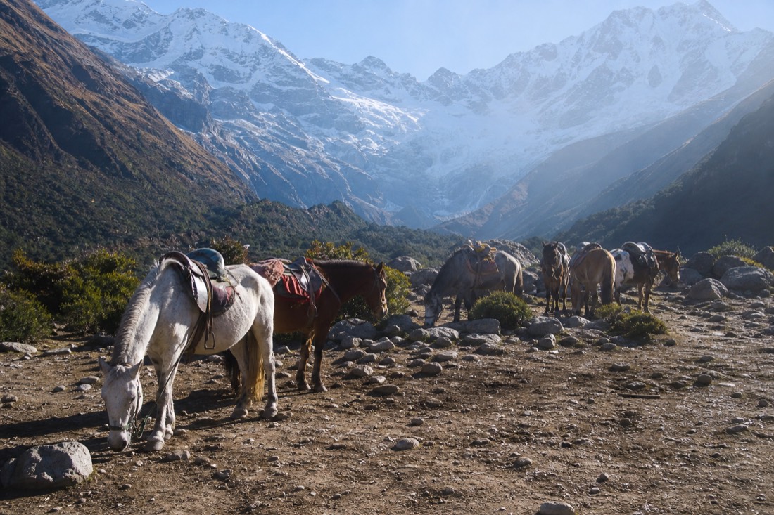
Yes, and there is no shame in it. Local horsemen at Soraypampa rent horses for about 80 soles one way, paid in cash on site and not managed by the tour operator. One catch: horses stop 15 to 20 minutes below the lake, so you still walk the final, steepest stretch yourself.
| Option | Cost | Time to the top | What you still walk |
|---|---|---|---|
| Walking | Free | 1.5-2 h | Everything |
| Horse one way up | ~80 soles, cash | ~1 h riding | Final 15-20 min on foot |
| Horse both ways | Negotiated on site | Varies | Final stretch, both directions |
I tell people to make the horse decision at the trailhead, not halfway up. Mounting mid-trail is possible when a free horse passes, but availability shrinks as the morning goes on. If you already know your acclimatization is thin, book the animal from the start and save your lungs for the last push. I wrote more about how that trade works, including who should take it without hesitating, in the horses guide.
One honest note on that final stretch: it is the steepest part of the whole trail. Riders sometimes find it harder than walkers do, because their bodies have not warmed up. Take it in tiny steps and it passes.
How should you pace the climb?
Walk slower than feels natural, breathe through a rhythm, and stop before you need to. My rule for guests: you should be able to speak a full sentence at any point on the trail. If you cannot, you are moving too fast for your oxygen supply, and the mountain will collect the debt within minutes.
The pacing trick I teach at the briefing is simple. Match your steps to your breath, two short steps per inhale, two per exhale, and shrink the steps on the steep ramps rather than stopping dead. Long standing breaks feel good but cool you down and break your rhythm. Thirty seconds, sip of water, move again.
A guided departure quietly solves most of the pacing problem for you. A guide sets a sustainable rhythm, schedules the rest stops, and carries oxygen for the worst case. If that sounds like the version of this day you want, book the Humantay Lake day trip with both meals included and check live availability and prices on GetYourGuide. The listing shows 4.8 stars across 3,809 reviews, and the small-group format matters here: smaller groups climb at a humane pace.
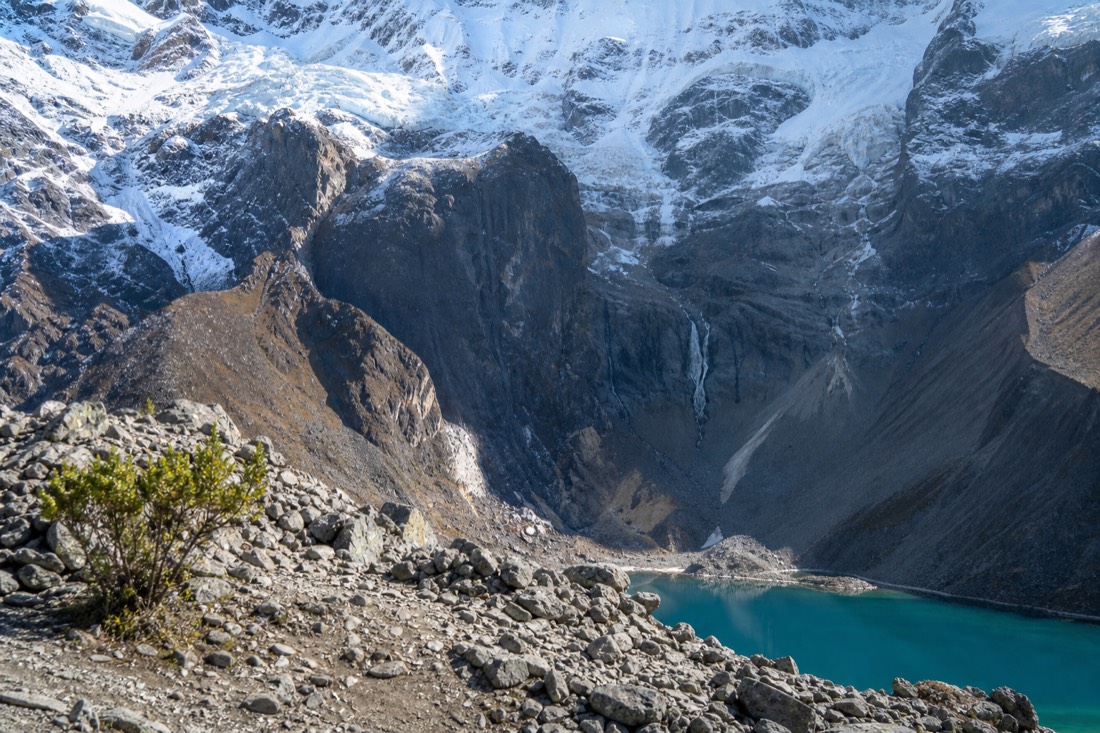
However you go, remember what the trail actually is: a short, steep, honest climb that rewards patience. Give it two slow hours and it gives you a turquoise lake under a glacier. That trade has never once struck me as unfair.
The mistakes I watch first-timers make on the switchbacks
The same handful of errors send most turnarounds back down the mountain, and almost none of them are about raw strength. Starting too fast, drinking too little, dressing for a postcard instead of the real weather, and treating the horse as a mid-trail rescue rather than a start-line choice: those four explain nearly every struggling walker I coach up this climb.
I can usually pick out, within the first ten minutes above Soraypampa, who reaches the shore easily and who fights for it. The tell is never the calf muscles. It is the pace someone sets off the trailhead, and the way they answer when I ask how many nights they have slept in Cusco. A fast marathon time impresses me far less than a calm second morning at 3,400 metres, because this mountain rewards adaptation over fitness every single time.
The pacing error is the big one. People feel strong across the flat meadow, push hard, and reach the base of the switchbacks already out of breath. From there the climb only steepens, and a lung that started the zigzags gasping rarely recovers on the way up. My fix is boring and it works: walk the meadow slower than your legs want, and keep enough breath to speak a full sentence at any point. If you cannot, you are spending oxygen you do not have.
Water is the quiet one. At altitude you lose fluid through faster breathing and dry air without noticing, and dehydration sharpens every symptom of soroche. I want to see people sipping steadily from the trailhead, not draining a bottle at the top. The last two mistakes, dressing wrong and leaving the horse decision too late, both grow from optimism. A clear dawn can turn to a cold, cloud-driven squall on the switchbacks in twenty minutes, and the free horses that pass early grow scarce as the morning fills. Sort both before you start, and read my what-to-pack list and the horses guide the night before so nothing is a surprise at 3:30 AM.
One mistake hides on the way down, when everyone relaxes. The descent is where most small falls happen, because the loose rock that felt secure under climbing feet slides under tired, hurrying ones. Lungs feel wonderful, so people trot, and a rolled ankle an hour from the trailhead sours a triumphant morning. Same discipline in reverse: short steps, the pole or walking stick out, eyes on your feet through the scree.
There is a social trap woven through all of this too. Groups tend to pace to their fastest, most eager member, and that person is almost never the one who will struggle. I spend real energy at the front slowing the keen walkers down, because when the group chases them, the quieter people at the back blow up without ever saying a word. If you are the strong one in your party, your job on this trail is to be boring company: short steps, frequent glances over your shoulder, no sprinting to the next bend for a photo. Get that right and your whole group reaches the shore. Get it wrong and someone pays for your enthusiasm.
| The mistake | What it costs on the trail | What I tell people instead |
|---|---|---|
| Charging the meadow ramp | Burns the reserve you need for the switchbacks | Walk it slower than feels natural, warm the legs up |
| Under-drinking | Dehydration deepens every altitude symptom | Sip steadily, clear two litres across the morning |
| Dressing for the postcard | A cold squall drains body heat fast | Hat, gloves and a shell in the pack, even on clear dawns |
| Leaving the horse call late | Free horses thin out as the morning goes on | Decide at the trailhead, not when your legs quit |
| Hiding symptoms from the guide | A small headache can grow into a real one | Speak up early; turning back is routine, not failure |
Why does 3 km at this altitude feel so much longer?
Two forces stack against you. The grade is genuinely steep, with sections recent hikers have measured between roughly 40 and 70 percent, and every one of those metres is earned in air holding around 60 percent of the oxygen you get at sea level. Distance is the wrong yardstick here. Vertical gain and thin air are the honest ones.
Look at a map and the trail seems trivial: 3 km, a couple of hours, done before lunch. The map cannot show grade or altitude, which is exactly why the numbers mislead. The two crowd-sourced trail listings for this route disagree on almost everything except that it climbs hard, one calling it a hard 3.6-mile outing with about 410 metres of gain, the other a moderate 2.8 miles with a near-identical climb. When the apps cannot agree, the variable is usually the walker, not the trail.
I break the grade down for groups because knowing what is coming steadies the mind. The meadow ramp is gentle, a warm-up that flatters you. The lower switchbacks bite at around 40 percent in places, and the steepest zigzags kick toward 65 or 70 percent in short bursts that force everyone into tiny steps. None of it needs hands or scrambling, and there is no exposure, but the sustained pitch is what people feel in their legs the next day.
| Trail segment | Approximate grade | What your legs read it as |
|---|---|---|
| Meadow ramp from the trailhead | Gentle, under 10 percent | An easy warm-up that tempts you to rush |
| Lower switchbacks | Around 40 percent in pitches | Steady, lung-burning, the real work starting |
| Steepest zigzags | Reported near 65-70 percent in bursts | Short steps only, stop-start breathing |
| Final moraine shelf | Steep but mercifully brief | A last push with the lake already in earshot |
Put a figure on the altitude and the trick becomes obvious. At sea level a 40 percent pitch is a hard, honest climb your lungs can bankroll. At 3,900 metres the same pitch is climbed on roughly two-thirds of the oxygen, so your heart and lungs work far harder to move the same legs the same distance. That is why gym-fit visitors who never think about their breathing suddenly hear nothing but it, twenty minutes above the trailhead. The grade did not change on the flight over. The air did, and the air is what the switchbacks charge you for.
The good news is that this is a climb you can prepare for, and preparation shifts the difficulty more than most people expect. You cannot train away 4,200 metres on a treadmill at home, but you can arrive with legs used to sustained uphill and a plan for the Cusco days that does the altitude work for you. Here is the rough shape I give friends who ask how to get ready.
| When to start | What actually helps | Why it pays off on this trail |
|---|---|---|
| 6-8 weeks out | Hill walking, stairs, a loaded daypack | Builds the climbing muscles the switchbacks tax most |
| 2-3 weeks out | Back-to-back walking days | Teaches your legs to recover overnight |
| The Cusco days | Gentle acclimatization walks, nothing hard | Adaptation to altitude beats any last-week gym block |
| Hike morning | Warm up slowly, eat breakfast, hydrate | A calm start protects the entire climb |
Notice which row of that table matters most. It is not the gym block, it is the Cusco days. I have watched supremely fit trail runners suffer on these switchbacks because they flew in the night before, and I have watched sedentary retirees stroll to the shore because they gave themselves three easy days at altitude first. Fitness sets your comfortable pace; acclimatization decides whether you get to use it, which is why my acclimatization guide is the one page I would read even if you skip everything else here.
One honest caveat on the training, though: do not overcook the final week. I meet people who arrive in Cusco already tired from a punishing pre-trip fitness block, then wonder why the altitude flattens them anyway. The body adapts to thin air best when it is rested, not depleted. Ease off the hard sessions in the week before you fly, arrive fresh, and let those quiet Cusco days do the real work. A tired body at 4,200 metres has nothing left to give the mountain when it asks.
If the timing of your trip is still flexible, the season underfoot changes the trail as much as your training does, and I lay that out in the best-time-to-visit guide and the month-by-month weather guide. Dry-season stone is grippy and honest; wet-season mud on those same switchbacks is a slower, more careful animal. Whichever way you prepare, the core truth from the top of this page holds: the walk is short, steep and fair, and the margin you build beforehand is what lets you lift your eyes off your boots and watch the glacier draw closer.